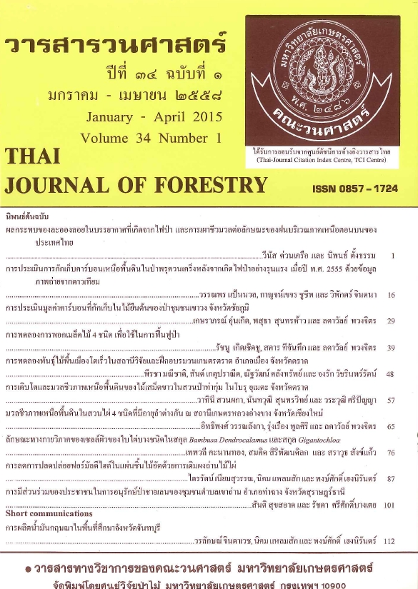
การประเมินการกักเก็บคาร์บอนเหนือพื้นดินในป่าพรุควนเคร็ง หลังจากเกิดไฟป่าอย่างรุนแรง เมื่อปี พ.ศ. 2555 ด้วยข้อมูลภาพถ่ายจากดาวเทียม
Main Article Content
บทคัดย่อ
งานวิจัยนี้เป็นการศึกษาประเมินการกักเก็บคาร์บอนเหนือพื้นดินของไม้ต้นในป่าพรุควนเคร็งหลังจากการเกิดไฟป่าอย่างรุนแรง เมื่อปี พ.ศ. 2555 โดยเริ่มจากการจำแนกสภาพป่าตามความสมบูรณ์และผลกระทบจากไฟป่าจากภาพถ่ายดาวเทียมไทยโชตด้วยวิธีการจำแนกข้อมูลภาพแบบกำกับ จากนั้นตรวจสอบความถูกต้องของการจำแนกเพื่อปรับปรุงคุณภาพผลการแปลแล้วจัดทำเป็นชั้นข้อมูลแผนที่ด้วยระบบสารสนเทศภูมิศาสตร์ จากนั้นทำการสุ่มวางแปลงตัวอย่างขนาด 30x30 เมตร ในแต่ละสภาพป่า เก็บวัดความโตและความสูงของไม้ต้นในภาคสนามเพื่อนำมาคำนวณหาค่ามวลชีวภาพเหนือพื้นดินด้วยสมการแอลโลเมตรีที่เหมาะสม พร้อมทั้งสุ่มเก็บตัวอย่างไม้ยืนต้นตายจากอิทธิพลไฟป่านำมาอบแห้งเพื่อสร้างสมการแอลโลเมตรีและหาค่าความเข้มข้นของคาร์บอน จากนั้นทำการประเมินปริมาณการกักเก็บคาร์บอนเหนือพื้นดินจากมวลชีวภาพที่คำนวณได้ และนำปริมาณการกักเก็บคาร์บอนเหนือพื้นดินภาคสนามไปหาความสัมพันธ์เชิงเส้นกับข้อมูลภาพถ่ายดาวเทียม Landsat 8 (OLI) เพื่อนำสมการที่เหมาะสมที่สุดไปใช้ในการประมาณค่าการกักเก็บคาร์บอนเหนือพื้นดินเชิงพื้นที่ของป่าพรุควนเคร็ง
ผลการศึกษาพบว่า การแปลภาพมีความถูกต้องโดยรวมร้อยละ 72.58 (Kappa coefficient = 0.63) ได้สมการแอลโลเมตรีสำหรับประมาณค่ามวลชีวภาพเหนือพื้นดินของไม้เสม็ดขาวยืนต้นตายซึ่งเป็นชนิดพันธุ์เด่นในพื้นที่ คือ W = 0.0381(DBH2H)0.8952 มีค่า R2 = 0.93 (W คือ มวลชีวภาพ) และค่าความเข้มข้นของคาร์บอนน้ำหนักแห้งมีค่าเฉลี่ยเท่ากับ โดย 48.21 เปอร์เซ็นต์ เมื่อประเมินมวลชีวภาพเหนือพื้นดินของพื้นที่ป่าพรุควนเคร็ง พบว่า มีมวลชีวภาพเหนือพื้นดินเฉลี่ย 37.92 ตันต่อเฮกตาร์ คิดเป็นปริมาณการกักเก็บคาร์บอนเหนือพื้นดินเฉลี่ย 17.83 ตันคาร์บอนต่อเฮกตาร์ จากการทดสอบความแตกต่างกันในทางสถิติของปริมาณการกักเก็บคาร์บอนเหนือพื้นดินของแต่ละสภาพป่า พบว่า ปริมาณการกักเก็บคาร์บอนเหนือพื้นดินในพื้นที่ป่าพรุสมบูรณ์กับป่าพรุเสื่อมโทรม พื้นที่ป่าพรุสมบูรณ์กับพื้นที่ไฟไหม้ปี พ.ศ. 2553 และพื้นที่ป่าพรุสมบูรณ์กับพื้นที่ไฟไหม้ปี พ.ศ. 2555 มีปริมาณการกักเก็บคาร์บอนเหนือพื้นดินแตกต่างกันอย่างมีนัยสำคัญที่ระดับความเชื่อมั่น 95 เปอร์เซ็นต์ ส่วนพื้นที่อื่นๆ มีปริมาณการกักเก็บคาร์บอนเหนือพื้นไม่แตกต่างกัน เมื่อทำการหาปริมาณการกักเก็บคาร์บอนเหนือพื้นดินในแต่ละสภาพป่าของพื้นที่ศึกษา ด้วยวิธีการดั้งเดิมที่ใช้ค่าเฉลี่ยต่อหน่วยเนื้อที่ของปริมาณคาร์บอนที่ได้จากการประมาณจากมวลชีวภาพบนฐานสมการแอลโลเมตรี พบว่า มีปริมาณการกักเก็บคาร์บอนเหนือพื้นดินของป่าพรุควนเคร็งรวมทั้งพื้นที่เท่ากับ 174,464.27 ตันคาร์บอน ในขณะที่การหาความสัมพันธ์ระหว่างปริมาณการกักเก็บคาร์บอนเหนือพื้นดินภาคสนาม (ตัวแปรตาม) กับข้อมูลภาพถ่ายดาวเทียม Landsat 8 (OLI) (ตัวแปรอิสระ) ด้วยการวิเคราะห์การถดถอยได้สมการที่ดีที่สุด คือ CS = 0.0323(G-R) - 6.5495 มีค่า R2 = 0.2126 (CS คือ ปริมาณการกักเก็บคาร์บอนเหนือพื้นดิน) เมื่อนำสมการไปประมาณปริมาณการกักเก็บคาร์บอนเหนือพื้นดินเชิงพื้นที่จากภาพถ่ายจากดาวเทียม Landsat 8 (OLI เมื่อ G คือ แบนด์ 3 Green, R คือ แบนด์ 4 Red) พบว่า มีปริมาณการกักเก็บคาร์บอนเหนือพื้นดินเท่ากับ 167,570.46 ตันคาร์บอน ต่ำกว่าการประมาณแบบดั้งเดิม
Downloads
Article Details

อนุญาตภายใต้เงื่อนไข Creative Commons Attribution-NonCommercial-NoDerivatives 4.0 International License.
ข้าพเจ้าและผู้เขียนร่วม (ถ้ามี) ขอรับรองว่า ต้นฉบับที่เสนอมานี้ยังไม่เคยได้รับการตีพิมพ์และไม่ได้อยู่ในระหว่างกระบวนการพิจารณาตีพิมพ์ลงในวารสารหรือสิ่งตีพิมพ์อื่นใด ข้าพเจ้าและผู้เขียนร่วม (ถ้ามี) ยอมรับหลักเกณฑ์และเงื่อนไขการพิจารณาต้นฉบับ ทั้งยินยอมให้กองบรรณาธิการมีสิทธิ์พิจารณาและตรวจแก้ต้นฉบับได้ตามที่เห็นสมควร พร้อมนี้ขอมอบลิขสิทธิ์ผลงานที่ได้รับการตีพิมพ์ให้แก่วารสารวนศาสตร์ คณะวนศาสตร์ มหาวิทยาลัยเกษตรศาสตร์ กรณีมีการฟ้องร้องเรื่องการละเมิดลิขสิทธิ์เกี่ยวกับภาพ กราฟ ข้อความส่วนใดส่วนหนึ่ง หรือ ข้อคิดเห็นที่ปรากฏในผลงาน ให้เป็นความรับผิดชอบของข้าพเจ้าและผู้เขียนร่วม (ถ้ามี) แต่เพียงฝ่ายเดียว และหากข้าพเจ้าและผู้เขียนร่วม (ถ้ามี) ประสงค์ถอนบทความในระหว่างกระบวนการพิจารณาของทางวารสาร ข้าพเจ้าและผู้เขียนร่วม (ถ้ามี) ยินดีรับผิดชอบค่าใช้จ่ายทั้งหมดที่เกิดขึ้นในกระบวนการพิจารณาบทความนั้น”


