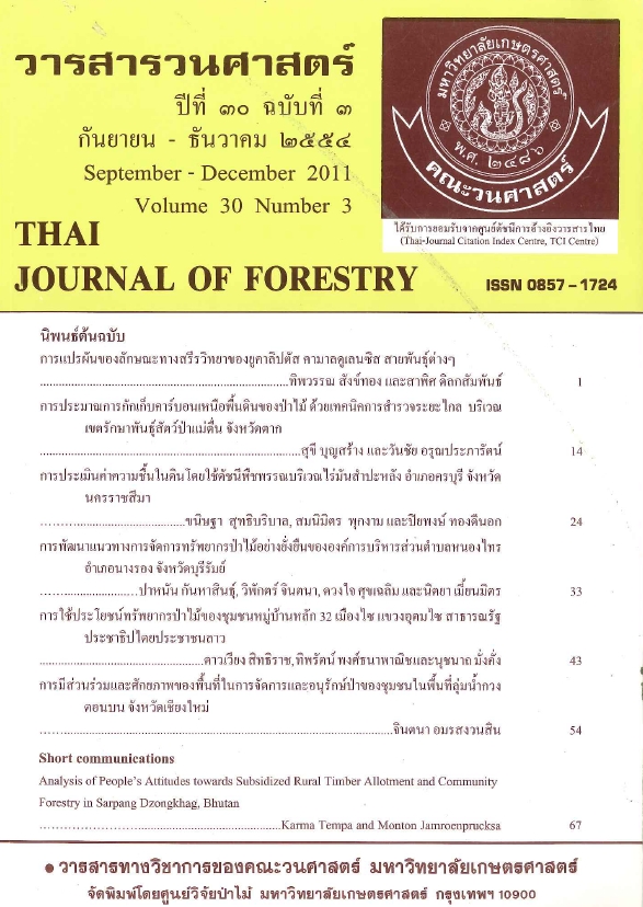
การประมาณการกักเก็บคาร์บอนเหนือพื้นดินของป่าไม้ ด้วยเทคนิคการสำรวจระยะไกล บริเวณเขตรักษาพันธุ์สัตว์ป่าแม่ตื่น จังหวัดตาก
Main Article Content
บทคัดย่อ
การศึกษาครั้งนี้มีวัตถุประสงค์ เพื่อประมาณการกักเก็บคาร์บอนเหนือพื้นดินของป่าไม้ด้วยเทคนิคการสำรวจระยะไกลบริเวณเขตรักษาพันธุ์สัตว์ป่าแม่ตื่น จังหวัดตาก โดยการวิเคราะห์สมการถดถอยหาความสัมพันธ์ระหว่างปริมาณการกักเก็บคาร์บอนที่อยู่เหนือพื้นดินกับค่าการสะท้อนช่วงคลื่นที่เกี่ยวข้องกับพืชพรรณจากข้อมูลภาพถ่ายดาวเทียม LANDSAT 5 TM ใน ปี พ.ศ.2550 ได้แก่ แบนด์ 2 (G) แบนด์ 3 (R) และแบนด์4 (IR) รวมทั้งค่าดัชนีที่เกี่ยวข้องกับพืชพรรณ ได้แก่ การลบแบบง่าย : IR–R การหารแบบง่าย : IR/R NDVI TVI และ GVI เพื่อหาสมการที่เหมาะสมที่สุดในการประมาณค่าการกักเก็บคาร์บอนเหนือพื้นดินของป่าไม้ บริเวณเขตรักษาพันธุ์สัตว์ป่าแม่ตื่น จังหวัดตาก
การศึกษาในครั้งนี้ได้สร้างสมการที่เหมาะสมที่สุดในการประมาณการกักเก็บคาร์บอนเหนือพื้นดิน (CS) ของป่าประเภทต่างๆ ในเขตรักษาพันธุ์สัตว์ป่าแม่ตื่นได้เป็นอย่างดี โดยสมการเพื่อการประมาณการกักเก็บคาร์บอนป่าดิบแล้งมีสมการที่เหมาะสมที่สุด คือ CS = 630.339 (R) – 74.019 และมีค่าสัมประสิทธิ์กำหนด (R2) เท่ากับ 0.839 ป่าดิบเขามีสมการที่เหมาะสม คือ CS = 327.630 (IR) – 27.974 (IR/R) – 36.188 และมีค่า R2 เท่ากับ 0.854 ป่าเบญจพรรณ มีสมการที่เหมาะสม คือ CS = 951.608 (IR–R) – 505.367 (IR) – 62.406 (IR/R) + 134.572 และมีค่า R2 เท่ากับ 0.741 และป่าเต็งรัง มีสมการที่เหมาะสม คือ CS = 53.140 (IR) – 41.031 (TVI) – 194.004 (G) + 59.783 และมีค่า R2 เท่ากับ 0.745 ในการประมาณการกักเก็บคาร์บอนเหนือพื้นดินของป่าไม้เขตรักษาพันธุ์สัตว์ป่าแม่ตื่น ในปีพ.ศ. 2550 โดยใช้สมการที่เหมาะสมสำหรับป่าประเภทต่างๆ นั้น สามารถประมาณการกักเก็บคาร์บอนเหนือพื้นดินได้ทั้งสิ้น 8,886,516.9 ตันคาร์บอน โดยป่าประเภทต่างๆ มีอัตราการกักเก็บคาร์บอนเหนือพื้นดินแตกต่างกันไปโดยที่ป่าดิบแล้งมีอัตราการกักเก็บคาร์บอนมากที่สุด รองลงมาคือ ป่าดิบเขา ป่าเบญจพรรณ และป่าเต็งรัง ตามลำดับ (129, 102.43, 80.16, และ 54.68 ตันคาร์บอนต่อเฮกแตร์)
คำสำคัญ: การกักเก็บคาร์บอน การสำรวจระยะไกล เขตรักษาพันธุ์สัตป่าแม่ตื่น จังหวัดตาก
Downloads
Article Details

อนุญาตภายใต้เงื่อนไข Creative Commons Attribution-NonCommercial-NoDerivatives 4.0 International License.
ข้าพเจ้าและผู้เขียนร่วม (ถ้ามี) ขอรับรองว่า ต้นฉบับที่เสนอมานี้ยังไม่เคยได้รับการตีพิมพ์และไม่ได้อยู่ในระหว่างกระบวนการพิจารณาตีพิมพ์ลงในวารสารหรือสิ่งตีพิมพ์อื่นใด ข้าพเจ้าและผู้เขียนร่วม (ถ้ามี) ยอมรับหลักเกณฑ์และเงื่อนไขการพิจารณาต้นฉบับ ทั้งยินยอมให้กองบรรณาธิการมีสิทธิ์พิจารณาและตรวจแก้ต้นฉบับได้ตามที่เห็นสมควร พร้อมนี้ขอมอบลิขสิทธิ์ผลงานที่ได้รับการตีพิมพ์ให้แก่วารสารวนศาสตร์ คณะวนศาสตร์ มหาวิทยาลัยเกษตรศาสตร์ กรณีมีการฟ้องร้องเรื่องการละเมิดลิขสิทธิ์เกี่ยวกับภาพ กราฟ ข้อความส่วนใดส่วนหนึ่ง หรือ ข้อคิดเห็นที่ปรากฏในผลงาน ให้เป็นความรับผิดชอบของข้าพเจ้าและผู้เขียนร่วม (ถ้ามี) แต่เพียงฝ่ายเดียว และหากข้าพเจ้าและผู้เขียนร่วม (ถ้ามี) ประสงค์ถอนบทความในระหว่างกระบวนการพิจารณาของทางวารสาร ข้าพเจ้าและผู้เขียนร่วม (ถ้ามี) ยินดีรับผิดชอบค่าใช้จ่ายทั้งหมดที่เกิดขึ้นในกระบวนการพิจารณาบทความนั้น”


