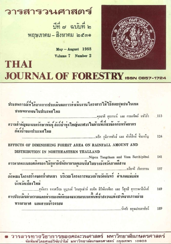
การประเมินค่าความแตกต่างของพิกัดของแนวขอบเขต พื้นที่ป่าสงวนแห่งชาติจากภาพถ่ายทางอากาศ และการเข้าวงรอบ
Main Article Content
บทคัดย่อ
การประเมินค่าแตกต่างของพิกัดของแนวขอบเขตพื้นที่จากภาพถ่ายทางอากาศ และแผนที่ที่ได้จากการเข้าวงรอบ ณ โครงการศึกษาเพื่อพัฒนาชนบทเกษตร มหาวิทยาลัยเกษตรศาสตร์ อำเภอโคกสำโรง จังหวัดลพบุรี เนื้อที่ประมาณ 48,918 ไร่ ความยาวของแนวขอบเขตพื้นที่ประมาณ 48 กิโลเมตร โดยใช้ภาพถ่ายทางอากาศมาตราส่วน 1 : 15,000 และแผนที่ระวางมาตราส่วน 1 : 50,000 ประกอบกันในการวัดค่าพิกัดของหมุดวงรอบ และวัดค่า parallax, ค่า relief displacement ของหมุดวงรอบ ค่า air base ของภาพคู่สามมิติ แล้วคำนวณค่าความสูงจากระดับน้ำทะเลปานกลางของเครื่องบินถ่ายภาพ ค่ามาตราส่วนและค่าความสูงจากระดับน้ำทะเลปานกลางของหมุดวงรอบ เพื่อคำนวณปรับแก้พิกัดที่วัดจากภาพถ่ายทางอากาศให้เป็นพิกัดที่อ้างอิงจากศูนย์กำเนิด และอยู่บนพื้นหลักฐานเดียวกันกับพิกัดของหมุดแนวเขตที่ได้จากการเข้าวงรอบทางภาคพื้นดินโดยวิธีสเตเดีย (stadia traverse) และคำนวณปรับแก้พิกัดโดยวิธี compass rule การเปรียบเทียบพิกัดของหมุด ที่วัดและคำนวณจากภาพถ่ายทางอากาศ กับพิกัดของหมูดเดียวกันที่วัดและคำนวณโดยการเข้าวงรอบทางภาคพื้นดิน โคยถือว่าพิกัดที่ได้จากการเข้าวงรอบเป็นพิกัดที่ถูกต้อง แล้วนำค่าแตกต่างของพิกัด X, Y มาวิเคราะห์ทางสถิติในรูปสมการสหสัมพันธ์ โดยวิธี stepwise กำหนดค่าแตกต่างของพิกัดหมุดวงรอบเป็นตัวแปรตาม และกำหนดค่าความสูงจากระดับน้ำทะเลปานกลางของเครื่องบินถ่ายภาพค่าความสูงจากระดับน้ำทะเลปานกลางของหมุดวงรอบ ค่า parallax และค่า relief displacement ของหมุดวงรอบ เป็นตัวแปรอิสระจำนวน 105 หมุด ได้สมการสหสัมพันธ์ สำหรับประเมินค่าความแตกต่างของพิกัดของหมุดวงรอบเพื่อใช้ปรับแก้พิกัดที่วัดและคำนวณจากภาพถ่ายทางอากาศให้เป็นพิกัดที่ถูกต้องดังนี้
ΔX = -1651.4657 – 0.5651H + 15.9294P – 0.5727E + 0.1061S
ΔY = -3282.7967 – 1.3756H + 27.0393P – 0.3221E + 0.2802S
เมื่อ ΔX, ΔY = ค่าแตกต่างของพิกัด X, Y, ตามลำดับ, ม.
H = ความสูงจากระดับน้ำทะเลปานกลางของเครื่องบินถ่ายภาพ, ม.
P = ค่า Parallax ของหมุดวงรอบ, มม.
E = ความสูงจากระดับน้ำทะเลปานกลางของหมุดวงรอบ, ม.
S = มาตราส่วนหมุดวงรอบ
สมการทั้งสองให้สัมประสิทธิ์ของการประเมินค่า (R2) เท่ากับ 0.9303 และ 0.9422 และให้ค่าความคลาดเคลื่อนของการประมาณเท่ากับ 31.8372 และ 44.3277 ตามลำดับ การนำสมการไปประเมินค่าแตกต่างเฉลี่ยพิกัด X, Y จำแนกตามมาตราส่วนหมุดวงรอบโดยการแทนค่าเฉลี่ยของตัวแปรทางขวาของสมการลงในสมการ ได้ค่าแตกต่างเฉลี่ยของพิกัดสำหรับใช้ปรับแก้พิกัดที่วัตและคำนวณจากภาพถ่ายทางอากาศให้เป็นพิกัดที่ถูกต้อง จำแนกตามมาตราส่วนดังนี้ เล็กกว่า 1 : 14,000, 1 : 14,000-1 : 13,500, 1 : 13,500-1 : 13,000, 1 : 13,000-1 : 12.500 ใหญ่กว่า 1 : 12,500 ค่าแตกต่างเฉลี่ยของพิกัด X (ΔX) เท่ากับ -172.530, -236.611, -68.056, - 108.789 ม. ตามลำดับ และค่าแตกต่างเฉลี่ยของพิกัด Y(ΔY) เท่ากับ -180.233, -274.580, -274.229, -85.153, -168.385 ม. ตามลำดับ
Downloads
Article Details

อนุญาตภายใต้เงื่อนไข Creative Commons Attribution-NonCommercial-NoDerivatives 4.0 International License.
ข้าพเจ้าและผู้เขียนร่วม (ถ้ามี) ขอรับรองว่า ต้นฉบับที่เสนอมานี้ยังไม่เคยได้รับการตีพิมพ์และไม่ได้อยู่ในระหว่างกระบวนการพิจารณาตีพิมพ์ลงในวารสารหรือสิ่งตีพิมพ์อื่นใด ข้าพเจ้าและผู้เขียนร่วม (ถ้ามี) ยอมรับหลักเกณฑ์และเงื่อนไขการพิจารณาต้นฉบับ ทั้งยินยอมให้กองบรรณาธิการมีสิทธิ์พิจารณาและตรวจแก้ต้นฉบับได้ตามที่เห็นสมควร พร้อมนี้ขอมอบลิขสิทธิ์ผลงานที่ได้รับการตีพิมพ์ให้แก่วารสารวนศาสตร์ คณะวนศาสตร์ มหาวิทยาลัยเกษตรศาสตร์ กรณีมีการฟ้องร้องเรื่องการละเมิดลิขสิทธิ์เกี่ยวกับภาพ กราฟ ข้อความส่วนใดส่วนหนึ่ง หรือ ข้อคิดเห็นที่ปรากฏในผลงาน ให้เป็นความรับผิดชอบของข้าพเจ้าและผู้เขียนร่วม (ถ้ามี) แต่เพียงฝ่ายเดียว และหากข้าพเจ้าและผู้เขียนร่วม (ถ้ามี) ประสงค์ถอนบทความในระหว่างกระบวนการพิจารณาของทางวารสาร ข้าพเจ้าและผู้เขียนร่วม (ถ้ามี) ยินดีรับผิดชอบค่าใช้จ่ายทั้งหมดที่เกิดขึ้นในกระบวนการพิจารณาบทความนั้น”


