Spatial Water Productivity for Rice Production in Chainat Province
Article Sidebar
Main Article Content
Abstract
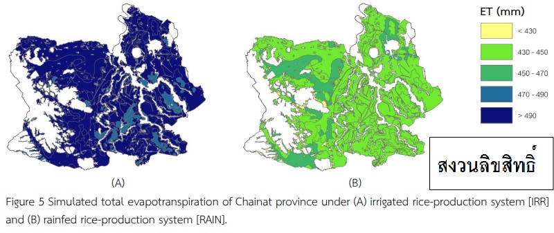
The spatial water productivity for rice production in Chainat province was assessed using the DSSAT-CERES model. Two rice production systems—irrigated system [IRR] and rain-fed [RAIN] system—were considered. Forty-eight cropping seasons (1970-2017) were simulated using daily time step. The results revealed that the rice water use [ET+P] attained 700 mm in the irrigated system, while it used approximately 500 mm in the rain-fed system. Irrigation increased the dry grain yield of 14% (from 714 kg·rai-1 [RAIN] to 803 kg·rai-1 [IRR]). Water productivity with respect to transpiration (WPT) [yield/transpiration] ranged from 2.5 to 2.6 kg·m-3 and water productivity with respect to total evapotranspiration (WPET) [yield/evapotranspiration] was of 1.0 kg·m-3. Irrigation practice and the soil properties, low hydraulic conductivity and high organic matter, can contribute the rice yield and its stability.
Article Details
use or modification of the articles is prohibited without permission.
statements expressed in the articles are solely the opinions of the authors.
authors are fully responsible for the content and accuracy of their articles.
other reuse or republication requires permission from the journal."
